The Standard Group Plc is a
multi-media organization with investments in media platforms spanning newspaper
print operations, television, radio broadcasting, digital and online services. The
Standard Group is recognized as a leading multi-media house in Kenya with a key
influence in matters of national and international interest.
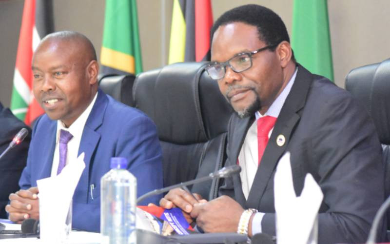
Director Shipping and Maritime Julius Segera (left) alongside MOESNA Secreatry General Kassim Mpaata, during the stakeholders consultative workshop on development of hydrographic services in the great lakes region in Nairobi. [Emmanuel Kipchumba, Standard]
African maritime experts are urging the modernisation of hydrographic services to address outdated navigational charts, some dating back to the 1960s.
Kassim Mpaata, Secretary General of the Maritime Organisation for Eastern, Southern and Northern Africa (MOESNA), called for urgent updates during a high-level consultative workshop in Nairobi.
“Most of our navigational charts are obsolete. In the Great Lakes region, where many water bodies are shared across borders, there is a pressing need for coordinated efforts to update hydrographic data and install modern navigational aids,” Mpaata said in a statement on Thursday, May 8.
The workshop gathered maritime experts, government officials, and development partners from member states to tackle the challenges of inland maritime services.
Key concerns included outdated charts, regulatory inconsistencies, a lack of cross-border cooperation, and insufficient maritime infrastructure.
Mpaata noted that hydrography, the science of mapping water bodies, is critical for maritime safety, trade, and resource management.
However, he pointed out that Africa has fallen behind in investing in this area, especially in inland waterways vital for landlocked nations.
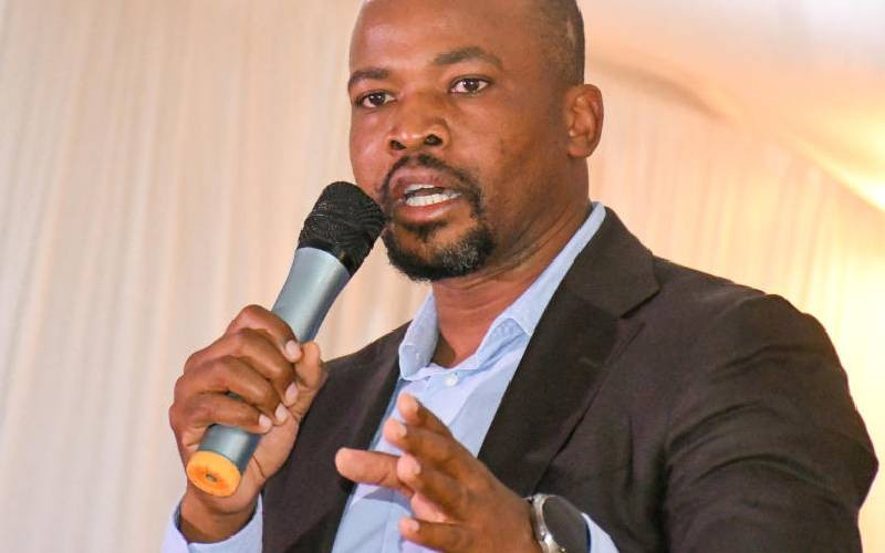
Director Shipping and Maritime Julius Segera , stressed the importance of regional coordination.
“We have established policies to enable transhipment through our ports and are working to enhance connectivity through the Standard Gauge Railway, road corridors like LAPSSET, and pipelines extending from Mombasa to Kisumu,” said Segera.
Segera also called for an expansion of MOESNA’s membership, which currently includes nine countries.
“Stronger cooperation will reduce transport costs, increase shipping efficiency, and improve access to essential goods across the region,” he added.
Major concern raised during the workshop was the legal requirement for vessel operators to carry updated hydrographic charts, despite these documents often being unavailable or unaffordable.
Participants warned that this regulatory gap could expose ship captains to legal risks even when they try to comply with maritime law.
Mpaata stressing the need for greater public-private partnerships and international support, adding, “Where our capacity is limited, we must seek technical and financial support to ensure safe and sustainable use of our water bodies,” he noted.
 The Standard Group Plc is a
multi-media organization with investments in media platforms spanning newspaper
print operations, television, radio broadcasting, digital and online services. The
Standard Group is recognized as a leading multi-media house in Kenya with a key
influence in matters of national and international interest.
The Standard Group Plc is a
multi-media organization with investments in media platforms spanning newspaper
print operations, television, radio broadcasting, digital and online services. The
Standard Group is recognized as a leading multi-media house in Kenya with a key
influence in matters of national and international interest.